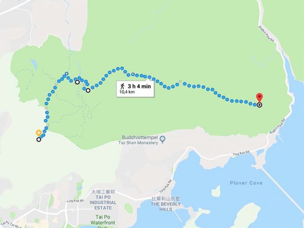
This is by far the most amazing part of the Wilson Trail. After a tough climb up the ridge, you are rewarded by some of the finest hiking conditions imaginable. Pat Sin Leng mountain has eight peaks the main peak is Wong Leng (639m) this section has 3 high peaks.
Highlights: The view over Tolo Harbour, Plover Cove and the green coasts of Sai Kung to the south and across the country park towards the border into China and Shenzhen’s skyscrapers. Stunning!!!!
How to get there: Take the MTR to Fanling station and take the green minibus no 52K near the station. Get off at Hok Tau Wai and walk uphill to the waterworks rd to the reservoir.
It takes about 1,5h to travel from Central to starting point.
How to get home: This section ends at the top of Sin Ku Fung, and it is best done together with section 10. You can walk to the south, but it is very steep and overgrown. It’ s easier to go off north, turn right onto Pat Sin Leng Nature Trail, just before W127 to reach Tai Mei Tuk. Down here at the village you can also find some restaurants. Go back to the Tai Po MTR station with minibus 20C or bus 75K.
It takes about 1,5h to travel back to Central from Tai Mei Tuk.


