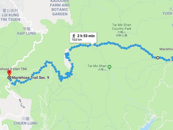
In this section you have the highest peak of Hong Kong, Tai Mo Shan, at 957m high. Here, you will get the most pleasing view from the highest point of Hong Kong with an excellent hike through a beautiful tropical landscape, on the ridge of Tai Mo Shan. The beginning and the end can be a bit rough because of the steps that seem endless.
Highlights: Tai Mo Shan, views of Tsuen Wan, Tsing Yi and Lantau Island, Man Wan Channel, Rambler Channel and Kap Shui Mui which leads ships to the famous Victoria Harbour
How to get there: Starting point Lead Mine pass. Take MTR to Tai Po Market, take green minibus 23K past Wun you to San Uk Ka and walk uphill, or go to Tai Po Kau nature reserve by taking bus 72 from Lai Chi Kok MTR station to Tsung Tsai Yuen and follow the woodland track to Lead Mine Pass.
How to get home: Ending point Route Twisk. Take bus no 51 from the near side of the road and get off at the Tsuen Wan West or Tsuen Wan MTR Station.


